

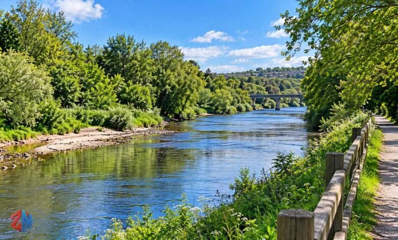
The River Ely is one of South Wales’s most interesting waterways, flowing from the hills near Tonyrefail through countryside, historic communities and western Cardiff before reaching Cardiff Bay. Known in Welsh as Afon Elai, this approximately 24-mile river connects natural landscapes with the region’s industrial heritage.
Although smaller than some of Wales’s better-known rivers, it has a fascinating history of industrial pollution, wildlife recovery and environmental conservation. Today, its green corridors provide habitats for fish, birds and rare plants while offering opportunities for walking, cycling and fishing.
This guide explores the river’s source, route, history, wildlife, environmental challenges and riverside attractions, including recent restoration projects.
What Is the River Ely?
The River Ely is a freshwater river in South Wales. It rises in the hills north of Tonyrefail in Rhondda Cynon Taf and flows southeast towards Cardiff Bay.
Its catchment, the area of land draining into the river and its tributaries, includes urban communities, agricultural land and wooded valleys. The river supports wildlife while also playing a role in local drainage and flood management.
River Ely Quick Facts
| Feature | Details |
|---|---|
| River name | River Ely |
| Welsh name | Afon Elai |
| Location | South Wales, United Kingdom |
| Length | Approximately 24 miles (39 km) |
| Source | Hills north of Tonyrefail |
| General direction | Southeast |
| Major tributary | River Clun |
| Mouth | Cardiff Bay |
| Main areas | Rhondda Cynon Taf, Vale of Glamorgan and Cardiff |
| Notable attraction | Ely Trail |
These geographical details are documented by Welsh river conservation organisations.
Where Does the River Ely Start and End?
The River Ely begins among the uplands surrounding Tonyrefail and eventually enters Cardiff Bay near Penarth Marina.
Its journey shows how the landscape changes from upland streams to agricultural valleys, suburban neighbourhoods and a redeveloped waterfront.
The Source of the River Ely
The river’s headwaters lie around Mynydd Penygraig, Mynydd y Gilfach and the slopes of Mynydd Dinas. Small streams collect rainfall from these hills and contribute to the developing watercourse.
Unlike several nearby South Wales rivers, the Ely does not have a large reservoir in its headwaters. Its upper reaches flow through a landscape shaped by valleys, settlements and former industrial activity.
The Middle Course Through South Wales
Further downstream, the Ely passes through the Pontyclun area, where it is joined by the River Clun, its largest tributary.
It then flows beneath the M4 motorway near Miskin and continues towards the Vale of Glamorgan countryside. Around Peterston-super-Ely and St Fagans, the river follows a winding course surrounded by farmland and woodland.
These meanders are important because they create different water depths, bank conditions and habitats for aquatic wildlife.
The River Ely’s Mouth at Cardiff Bay
The lower river travels through western Cardiff before entering the southwestern side of Cardiff Bay near Penarth Marina.
Its waters eventually reach the Severn Estuary and Bristol Channel through the managed Cardiff Bay Barrage system.
River Ely and Cardiff Bay
Cardiff Bay is one of the most recognisable locations associated with the river. However, the relationship between the river and the bay has changed considerably.
Before the Cardiff Bay Barrage was completed in 1999, tidal water entered the lower river system. The barrage transformed the bay into a managed freshwater lake, changing the environment near the river’s mouth.
The structure uses sluice gates to control water levels and includes a fish pass that helps migratory fish, particularly salmon and sea trout, travel between the estuary and the rivers.
This engineering system allows Cardiff Bay to support waterfront recreation while continuing to receive freshwater from the Ely and River Taff.
River Ely History and Industrial Heritage
The history of the River Ely reflects the transformation of South Wales during the Industrial Revolution.
During the nineteenth century, coal mining, iron production and paper manufacturing expanded across the region. While these industries created employment, they also contributed to severe river pollution.
Industrial Pollution and the Ely Paper Mill
The Ely Paper Mill, established in the early 1870s, became an important industrial site along the river.
Historically, industrial wastewater containing bleaching chemicals entered the watercourse. Discharges associated with mining and metalworking also caused serious environmental damage.
Historical accounts describe periods when the river became discoloured and unsuitable for livestock to drink.
As heavy industry declined and pollution controls improved, conditions gradually became better. Nevertheless, the river’s industrial legacy remains important to understanding its environmental challenges.
Penarth Dock and Maritime History
The river also connects with the maritime development of South Wales.
Penarth Dock opened in 1865 and became an important coal-exporting facility. On 6 February 1886, the famous ship SS Great Britain departed from Penarth carrying coal bound for Panama. After suffering storm damage near Cape Horn, it diverted to the Falkland Islands, where its commercial sailing career ended.
The dock eventually closed in 1963. Its former location was later redeveloped into Penarth Marina, creating a very different waterfront landscape.
River Ely Wildlife and Natural Habitats
Despite its industrial past, the River Ely supports a varied ecosystem.
Its water, surrounding trees, grassland and riverbanks provide places where wildlife can feed, shelter and reproduce.
Fish Species in the River Ely
The river contains several freshwater fish species, although their distribution varies between different stretches.
Recorded species include brown trout, grayling, pike, perch, roach, chub, carp and eels. Sea trout and salmon have also been recorded, while barbel have appeared following fisheries improvements.
Fish populations remain vulnerable to pollution, damaged habitats and obstacles that prevent movement between different sections of the river.
Birds, Otters and Riverside Plants
The Ely Valley provides habitats for kingfishers, herons, dippers and other birds associated with waterways.
Otters also occur along the river, although they are elusive and difficult to observe.
Sections of the riverside woodland support seasonal wildflowers, including bluebells, wood anemones and wild garlic. These habitats make the valley an important green corridor through developed areas.
Ely Valley Site of Special Scientific Interest
A particularly significant feature is the Ely Valley Site of Special Scientific Interest (SSSI).
This protected area supports the rare wild plant monkshood (Aconitum anglicum). Its distinctive flowers contribute to the ecological importance of the valley.
However, monkshood is highly poisonous. Visitors should avoid touching or collecting it and should leave protected plants undisturbed.
River Ely Pollution and Water Quality
Although the river has recovered from some of its worst historical pollution, its environmental condition remains a concern.
Problems identified by conservation organisations include wastewater pollution, industrial and urban runoff, physical alterations to river channels and barriers to fish migration.
Invasive plants such as Japanese knotweed and Himalayan balsam can also affect riverbank habitats by competing with native vegetation.
Importantly, the return of some wildlife does not mean that the river has achieved good ecological status. Water quality assessments consider several factors, including chemicals, aquatic organisms and the condition of habitats.
Natural Resources Wales has identified the Ely catchment as an area for coordinated efforts to reduce pollution and improve river health.
River Ely Restoration and Conservation Projects
Environmental restoration has become an important part of the River Ely’s modern story.
Conservation work aims to improve habitats, reconnect floodplains, support fish movement and reduce the effects of past engineering modifications.
Nant Dowlais River Restoration
In November 2024, Natural Resources Wales announced the completion of a major restoration project on Nant Dowlais, a tributary near St Fagans.
The project improved approximately 750 metres of stream habitat and added around 200 metres of channel length by restoring more natural bends.
The work also improved connections to the floodplain and introduced measures to protect riverside vegetation from livestock damage.
These changes were designed to create better conditions for wildlife, including fish and otters.
Environmental Improvements in 2025 and 2026
Further activity continued during the 2025–2026 financial year.
Natural Resources Wales reported installing 30 small flow-slowing barriers on Nant y Cesair in Tyn Y Coed Woods. Additional work improved a short tributary section in Llantrisant Woods.
Feasibility studies also examined opportunities for more natural flood management at Coed Ely and Nant Mychydd.
These projects illustrate a wider approach to restoring natural processes rather than relying solely on engineered river defences.
River Ely Walking Trail: Exploring the Riverside
The River Ely walking trail offers one of the most accessible ways to experience the landscape.
Known as the Ely Trail, this route extends approximately seven miles between the Cardiff Bay area and St Fagans.
Much of the trail is traffic-free and suitable for walking and cycling, although some sections use local roads.
What Can Visitors See Along the Ely Trail?
The route includes the Pont y Werin Bridge area, Grangemoor Park, wooded riverside sections and routes leading towards St Fagans National Museum of History.
Visitors can enjoy opportunities for wildlife watching, photography and peaceful walks through contrasting urban and natural surroundings.
Some sections have been affected by development-related diversions, so checking the latest official route information before travelling is advisable.
Tips for Visiting the River Ely
Wear suitable walking shoes, particularly after rain when riverside paths may become muddy.
Carry drinking water and keep a safe distance from steep or slippery banks. Spring can be particularly attractive for woodland flowers, while quieter periods may offer better wildlife-viewing opportunities.
River Ely Fishing Opportunities
Fishing is another recreational activity associated with the river.
Glamorgan Angling Club manages fishing opportunities on sections extending from the St Fagans area towards Cardiff Bay.
Different parts of the river support different species. Anglers may encounter trout and grayling in some upper sections, while lower stretches provide opportunities for coarse fishing, including pike.
Anyone planning to fish should confirm the required rod licence, local fishing permissions, applicable seasons and current conservation rules before visiting.
River Ely Flooding and Flood Management
Flooding is an important issue for communities near the river, particularly during prolonged or heavy rainfall.
Historical flooding has affected locations around Ely Bridge and Cowbridge Road West in Cardiff. Debris accumulating beneath bridges can restrict water flow and increase flood risk.
Natural Resources Wales installed a tree-catching structure upstream of Ely Bridge to intercept large debris before it reaches the road bridge.
The agency reports that the scheme has reduced flood risk for approximately 490 properties in the Ely and Fairwater areas. However, flood protection measures cannot eliminate all risk.
Residents and visitors should follow official flood warnings and avoid riverbanks, flooded paths and bridges during dangerous conditions.
Why Is the River Ely Important to South Wales?
The River Ely contributes to South Wales in several ways.
Environmentally, it connects woodland, farmland and urban green spaces while supporting wildlife populations. Historically, it reflects the industrial and maritime development of the region.
For local communities, the river also provides opportunities for recreation, learning and conservation.
Its future depends on continued efforts to manage pollution, protect habitats and reduce flooding.
Conclusion
The River Ely is more than a watercourse passing through South Wales. Its journey from the hills near Tonyrefail to Cardiff Bay reveals a landscape shaped by nature, industrial development and modern environmental restoration.
From its protected wildlife habitats to the popular Ely Trail, the river offers opportunities to explore local history and the natural environment.
Although pollution and flooding remain significant challenges, conservation projects demonstrate continuing efforts to improve the river’s ecological condition and protect its future.
Also Read: What Is the One In, One Out Policy? Meaning, Rules, and Decluttering Guide
Frequently Asked Questions
Where is the River Ely located?
The River Ely is in South Wales, United Kingdom. It flows through parts of Rhondda Cynon Taf, the Vale of Glamorgan and Cardiff before entering Cardiff Bay near Penarth Marina.
How long is the River Ely?
The river is approximately 24 miles (39 kilometres) long. It begins in the hills north of Tonyrefail and follows a generally southeastern course towards Cardiff Bay.
Where does the River Ely start?
The River Ely begins in upland areas near Tonyrefail, with headwaters around Mynydd Penygraig, Mynydd y Gilfach and Mynydd Dinas.
Can you walk along the River Ely?
Yes. The Ely Trail provides an approximately seven-mile route between the Cardiff Bay area and St Fagans. Much of it is traffic-free, although visitors should check for temporary diversions.
What fish live in the River Ely?
Recorded species include brown trout, grayling, pike, perch, roach, chub, carp and eels. Sea trout, salmon and barbel have also been reported, although their abundance varies.
Is the River Ely clean and safe for swimming?
The river has experienced improvements since its heavily polluted industrial past, but water quality remains a concern. It should not be assumed safe for swimming. Visitors should use officially assessed bathing locations instead of entering an unfamiliar stretch of river.